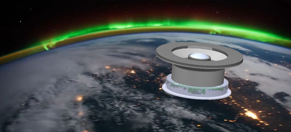
Deployment of an ASHI at a geostationary location (GEO), or an ASHI in low-earth orbit (LEO - shown here), will provide a map covering all the sky further than 2 degrees from the Sun's disk from a combination of individual hempisheric images. Here, about a 5-minute ensemble of multiple exposures give the requisite 0.1% differential photometry. In both GEO and LEO, the Moon, Earth, and Sun provide a three-object plane where all three must be avoided for ASHI to operate effectively.
|
|